The Challenge
Faced with a rapidly expanding portfolio of large infrastructure projects in remote locations across Canada, enforcement Officers with the Impact Assessment Agency of Canada (IAAC) required new tools to effectively monitor compliance and investigate incidents that negatively impacted the environment.
The Solution
I conducted deep-dive research to produce a bespoke implementation strategy that integrated drone technology and remote sensing workflows, specifically tailored for IAAC operations.
The Impact
The strategy provided IAAC officers with a comprehensive roadmap that:
Enhanced Officer Safety: Utilizing remote sensing to avoid sending personnel into hazardous field conditions.
Streamlined Compliance: Establishing efficient methods for continuous environmental impact monitoring.
Data Integrity: Providing guidance on chains of custody to support potential enforcement actions.
Case Study #1: Modernizing Monitoring Operations for Environmental Compliance Officers

The Challenge
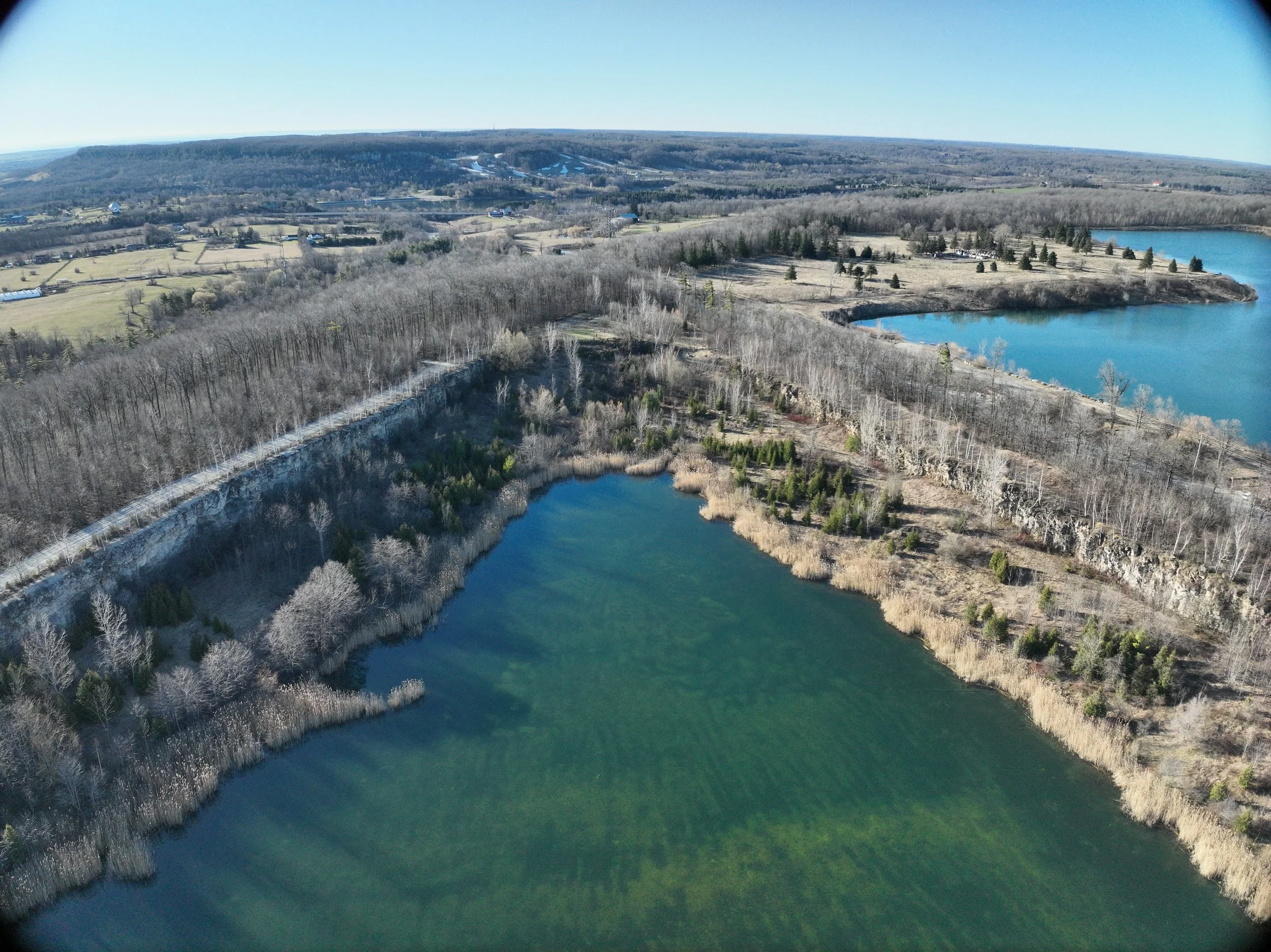
rare, a charitable environmental land trust and research institute, was investigating effective methods to eradicate invasive phragmites, an aquatic plant detrimental to wetlands and local biodiversity, on a newly acquired property.
The Solution
UAVs (drones) equipped with multispectral sensors captured comprehensive baseline data across the entire area, including difficult-to-access regions.
The Impact
Several high-resolution aerial maps, Digital Elevation Models (DEMs), and vegetation indices provided critical intelligence to support rare’s restoration and conservation activities and provided a general indication of aquatic ecosystem health.
Aerial maps showed the density and extent of invasive phragmites throughout the property, and wildlife activity in the water.
Digital Elevation Models (DEMs) showed the location of housing within the floodplain
Vegetation health maps (NDRE, and NDVI) provided insight into vegetation health and a visual estimate of turbidity upstream.

Case Study #2: Mapping Invasive Aquatic Plant and Vegetation Health.

The Challenge
Proposed land-use conversion, from agricultural to residential land-use, raised questions among stakeholders about the status of natural assets. The Primary Consultant needed aerial imagery to facilitate communication on the ecological restoration solutions integrated into the development project.
The Solution
Drones were used to create an aerial "virtual site survey" for stakeholders and decision-makers. We provided high-resolution visual data for the area of interest. The aerial imagery provided a visual context for the restoration and development projects.
The Impact
The aerial imagery and videos provided stakeholders with a clear, collective understanding of the on-site natural assets. It enabled effective communication of planned improvements to increase biodiversity and augment the provision of ecosystem services.

Case Study #3: Land Conversion and Stakeholder Communication